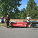
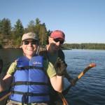
Tim Eaton, proprietor of Canoeing.com, paddled on the Canoe the Heart expedition on legs B and C and shared this trip report and photos:
The start point for this leg of the ‘Heart’ was the Ash River Visitors Center on Kabetogama Lake in Voyageurs National Park (VNP). Paddlers assembled at Whispering Pines Cabin 41 on the afternoon of July 4th 2009. Departure was scheduled for 6 am on July 5th and after a sunrise breakfast the big 27’ North Canoe was rolled over, lifted into the water, the paddling stations are assigned, the gear loaded and with paddlers on board, this leg of the voyage was underway. Time– 6:30 am sharp.
The morning was perfect– the big lake was calm, reflecting a cloudless blue sky above. The early morning temperature was plus or minus 60 degrees, and the day would prove to be sunny and hot, cooled by an occasionally light breeze from the northwest.
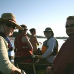
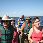
This leg of “the Heart” was lead by Kathleen Przybylski of VNP and Rich Kelly of HOCP and the Quetico Foundation. Together they navigated us through Voyageurs, Rich in the stern, Kathleen with her set of maps is the next position aft and Holly Armstrong from the Quetico Provincial Park (QPP) assigned the bow position to lead the crew of six in strokes. Keeping up with Holly proved to be an arduous task for everyone on board, she’s a strong, trim Quetico beauty experienced in paddling the big 27’ Voyageur canoe.
We stopped every 30 minutes to hydrate and switch paddling sides– six of us were seated side-by-side, two to a seat. At the first rest stop, Rich reassigned paddling stations to balance body weights, paddling strengths, and to maximize our performance. We were on a mission and flying across the big waters of Voyageurs National Park. By 10:30 we covered 20 miles and by lunch 27. We made our final destination, a campsite at King Williams Narrows on Crane Lake, an hour and a half ahead of schedule, at 2:00. We paddled 32 miles in seven and a half hours including our stop for lunch and a refreshing swim.
After setting up camp we paddled three miles future to the Voyagaire Lodge on Crane Lake where we rendezvoused with leg C paddlers and officials from VNP, QPP and Superior National Forest. Leg B paddlers took their leave and leg C paddlers returned to camp to prepare for the next day’s departure to Fall lake in Ely.
The Route:
Morning: Sullivan Bay on Kabetogama Lake eastward past Old Dutch Bay, Blind Indian Narrows, north of Williams Island and Hoist Bay, turning south of Namakan Island, passing between the narrow passage at Two Alligator Island and into Namakan Lake. Now paddling in Canadian waters with a bearing of due East, past Randolph Island and onto big open water. Six miles out on the horizon is the navigation point Pat Smith Island. Follow the Blind Pig Channel into Namakan Narrows and on into Sand Point Lake.
Lunch stop: a point of land just north of Burn Island and the site of an old cabin foundation.
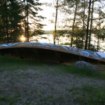
Head southwest past Burn Island for Harrison Narrows four miles down the lake. Continue south another four miles through King William Narrows and to the final destination, a camp site on a point of land just north Indian Island.
Distance: 32 miles, Time: 7.5 hours.
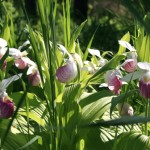
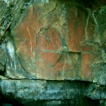
Highlights: Big open waters of Voyageurs National Park. The hundreds of islands found throughout the Park. The cliffs of Namakan, Harrison and King Williams Narrows. The pictographs at Namakan Narrows. The flowering Lady Slippers. The interesting names of the islands and bays as well as the stories and tales associated with each.
Maps
McKensie series maps
Scale 1:31,680
Three maps are needed to recreate this Leg of Paddle the Heart: K1- Kabetogama N1- Namakan, Sand Point and C1- Crane, Sand Point. The maps have the US Coast Guard Navigation aids/symbols for motorboat travel.
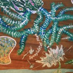
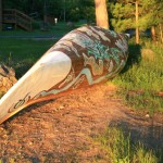
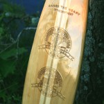
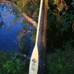
Photos: